By Ellin Youse and Jamell Brown-Smith
Editor-in-Chief and Transcript Reporter
Departments at Ohio Wesleyan University are using small, pilotless aircrafts, or drones, to cheaply produce content that would otherwise cost thousands of extra dollars.
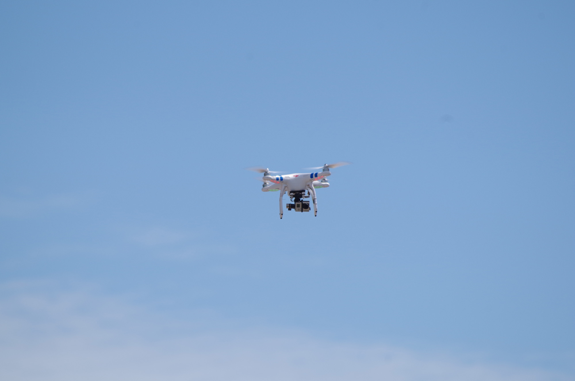
Drone is a term that is often applied to robotic devices in general, but in OWU’s case, the drone is a small flying device and is controlled by a pilot on ground and used to record video and collect data or footage for athletics.
The OWU drones are DJI Phantoms, the most popular “quadcopter” model available. A quadcopter is a small, multirotator helicopter with four blades and can attach a small camera to record information from a bird’s eye view. At a starting price of $479.99 for the older model of the Phantom One, the unit is a more stable and sophisticated version of a remote-controlled helicopter.
While The Phantom does not possess many of the features that make drones the platform of choice for overhead imaging, like the ability to plot a course remotely and send the craft on its way without a need for pilot input, its durability, in-flight stability and relatively cheap price tag made it a solid choice for campus drones.
Aircraft on Campus
OWU’s geography-geology and athletics departments have each adopted a drone, and for very different reasons. At a starting price of $479.99 for the older model of the Phantom One, the unit is essentially a more stable and sophisticated version of the remote-controlled helicopters most are familiar with.
While The Phantom does not possess many of the features that make drones the platform of choice for overhead imaging, like the ability to plot a course remotely and send the craft on its way without a need for pilot input, its durability, in-flight stability and relatively cheap price tag have made it the platform of choice on campus.
For artistic or scientific purposes, drones are doing work that would have been reserved for planes and helicopters before modern technology became so widely available.
Geography/ Geology professor and Geographic Information Systems expert for the university, John Krygier, has been working with senior Christian Gehrke as a part of the Student Assistantship Program (StAP) to use this technology to produce extensive, up-to-date remote sensing data on local vegetation. A modified GoPro camera is helping the pair monitor the health of vegetation in the Delaware area.
“We had an issue in that everyone straps a GoPro to it (drone), but we wanted to work with more than visual light reactions,” Krygier said. “Infrared (IR) is useful for many things, in particular for getting information about vegetation. Healthy vegetation will appear red on our camera. Farmers will use this to see what parts of their fields are stressed or for detecting pest infestations.”
The IR sensor Krygier and Gehrke took some ingenuity to adapt to the GoPro, but the pair are making progress.
After a year of trial and error efforts, they are able to use the drone to take overhead images of an area and stitch them together into usable, geotagged maps of those regions.
Once the process has been streamlined, Krygier said he would like open up the platform and data produced for use by students and teachers.
While Krygier and Gehrke have made a lot of progress, their current work presents only a proof of concept. The pair hopes to upgrade to a more sophisticated drone capable of maintaining constant altitude or flying a predetermined path without the guesswork of their current system.
In the athletics department, the football team has been working with video producer Bill Reynolds to gather new perspectives for their videos.
“I used it to get overhead shots of the team and the scoreboard when they came out to start the game, just a different angle to shoot from,” Reynolds said. “I use a pole to get similar footage, the drone is just one more tool to that end.”
The Phantom that Reynolds uses is equipped with a gimbal that keeps the camera steadier while in flight, enabling smooth, continuous shots even while the drone is in motion. Reynolds and the athletic department are still formulating new ways to use images captured by the drone.
In another instance of drones making an appearance on Selby Field, the Ohio Machine men’s lacrosse team also used drones to record footage of games. President and general manager of the Machine, John Algie, said the team worked with the local company, Infinite Impact, to provide in-game drone services.
“This was a great partnership for us because it created really unique perspectives for our fans,” Algie said. “One of our most popular uses of the drone was for our ‘Infinite Impact Drone Fan Cam’ which panned over the crowd while simultaneously broadcasting the footage onto the Selby Stadium video board. Our fans really got excited for it. We were also able to incorporate some of the drone photography into promotional videos, which serves as a real attention-grabber.”
After his use with drones, Algie said he could understand why universities would be interested in using drones more frequently.
“Drone cams can be great for showcasing a product or service,” he said.
“I can see a university such as Ohio Wesleyan, which has such a beautiful campus, using drone photography to create really special admissions recruiting videos that showcase what it looks like to attend OWU.”
